Import a GPX file

Lancaster trails

Click on a trail to view its statistics, map and profile.
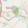
Morning round trip around Nashua River from Lancaster

United States > Massachusetts > Worcester County > Lancaster > Ponakin Mill

Lancaster Trails, Cook Conservation Area, Nashua River, Chapman-Goodale Conservation Land, Lancaster State Forest

Distance: 9.2 Km • Elevation gain: 91 m • Maximum elevation: 115 m

Other places

Gear up for your next adventure:

🐦Irish Bird Guides - Spot coastal and mountain birds during your hike
🌧️Rain Gear for Hiking - Waterproof gear sets for wet hikes
🗺️Irish Road Atlases - Comprehensive physical maps for road trips and navigation
🧢Hiking Hats & Caps - Protective headwear for sun and rain
🎒Fully Waterproof Rucksacks - Submersible protection for river crossings

As an Amazon Associate, this site earns from qualifying purchases at no extra cost to you.