Import a GPX file

Philippeville trails

Click on a trail to view its statistics, map and profile.
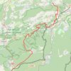
GR654-4 (0) GR 654, Belgique

Belgium > Namur > Philippeville > Couvin > Brûly

Distance: 47.0 Km • Elevation gain: 862 m • Maximum elevation: 371 m
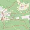
Wanyi Park Company

Belgium > Namur > Philippeville > Oignies-en-Thiérache

Distance: 26.6 Km • Elevation gain: 493 m • Maximum elevation: 385 m

Other places

 •

Gear up for your next adventure:

🥄Titanium Sporks - Indestructible and ultralight eating utensil
🕶️Polarized Sunglasses - Reduce glare outdoors
🔨Multi-tool Devices - Versatile tools for gear repairs in the field
🧤Thermal Outdoor Gloves - Windproof and waterproof gloves for winter hiking
🧗Rock Climbing Gear - Essentials for the cliffs of Moher or Gap of Dunloe

As an Amazon Associate, this site earns from qualifying purchases at no extra cost to you.