Import a GPX file

Aberfeldy trails

Click on a trail to view its statistics, map and profile.
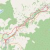
EMTB: Aberfeldy to Grandtully - Incl Rob Roy Way

United Kingdom > Scotland > Perth and Kinross > Aberfeldy

Loop

Distance: 20.1 Km • Elevation gain: 267 m • Maximum elevation: 146 m
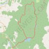
EMTB Gravel: Loch of Grandtully - Loop

United Kingdom > Scotland > Perth and Kinross > Aberfeldy

Around Loch Grandtully #UK #Perthshire #Aberfeldy #Griffin #Wood

Distance: 17.9 Km • Elevation gain: 341 m • Maximum elevation: 457 m

Gear up for your next adventure:

🎒Hiking Backpacks - Durable backpacks for day hikes and multi‑day treks
⌚Solar Multisport Watches - Advanced mapping and GPS tracking for endurance hikers
💧Portable Water Filters - Safe drinking water from streams and lakes
🔋Lithium Batteries - Best performance for digital devices in cold weather
🔋Solar Power Banks - Keep your GPS and phone charged in the Irish wilderness

As an Amazon Associate, this site earns from qualifying purchases at no extra cost to you.