Import a GPX file

La Côte-de-Gaspé trails

Click on a trail to view its statistics, map and profile.
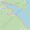
Gaspé - Saint-Georges-de-Malbaie

Canada > Quebec > La Côte-de-Gaspé > Gaspé > Cap-aux-Os > D'Aiguillon

Forillon National Park. Gulf of Saint Lawrence. #Bike #Gaspé #SaintGeorgesDeMalbaie #Forillon #SaintLawrence #Atlantic

Distance: 75.8 Km • Elevation gain: 796 m • Maximum elevation: 80 m

Other places

Gear up for your next adventure:

🪓Camping Hand Axes - For processing wood during forest camping
🥛Insulated Flasks - Keep drinks hot or cold
Emergency Bivvy Bags - Life-saving heat-reflective shelter for emergencies
🚲Cycling GPS Computers - Topographic mapping for Irish road and mountain biking
🔗Locking Carabiners - Secure gear to your pack or for light climbing

As an Amazon Associate, this site earns from qualifying purchases at no extra cost to you.