
Adams County trails
Click on a trail to view its statistics, map and profile.
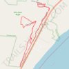
Ohio River Bluffs Loop and Ginger Ridge Loop
United States > Ohio > Adams County
Distance: 4.4 Km • Elevation gain: 183 m • Maximum elevation: 270 m
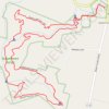
Quiverheart Falls Trail and Whispering Fern Trail Loop at Quiverheart Gorge Nature Reserve
United States > Ohio > Adams County > Jacksonville
Distance: 5.1 Km • Elevation gain: 103 m • Maximum elevation: 251 m

Red Trillium Loop at Rock Run Nature Preserve
United States > Ohio > Adams County
Distance: 5.3 Km • Elevation gain: 229 m • Maximum elevation: 315 m

Chaparral Prairie South Trails
United States > Ohio > Adams County
Distance: 2.3 Km • Elevation gain: 27 m • Maximum elevation: 284 m

Joan Joenes Portman Trail
United States > Ohio > Adams County
Distance: 1.4 Km • Elevation gain: 4 m • Maximum elevation: 259 m