Import a GPX file

Fusine in Valromana trails

Click on a trail to view its statistics, map and profile.
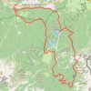
Fusine Rifugio Zacchi Capanna Ponza .

Italy > Friuli – Venezia Giulia > Udine > Tarvisio > Fusine in Valromana > Villabassa

Distance: 20.3 Km • Elevation gain: 1,109 m • Maximum elevation: 1,645 m

Other places

Gear up for your next adventure:

🥘Camping Cookware Sets - Cookware sets for backpacking meals
📦Outdoor Storage Bags - Keep gear organized and dry
🏃‍♀️Running Hydration Belts - Hydration on the go for runners
🌲Survival Gear - Equipment for outdoor survival situations
🧊Winter Boot Traction - Grip for icy paths in the Mourne or Derryveagh mountains

As an Amazon Associate, this site earns from qualifying purchases at no extra cost to you.