Import a GPX file

Kanahena trails

Click on a trail to view its statistics, map and profile.

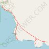
La Perouse Bay and King's Highway (Maui Island)

United States > Hawaii > Maui County > Kanahena

Hike along La Perouse Bay (Keoneʻōʻio Bay) and King's Highway from Keoneʻōʻio via Hoapali Trail, King's Highway and Hanamanioa Point Light on Maui Island. #Hiking #Sea #Pacific #Ocean #Volcano #Island #Hawaii #Nature #Mountain

Distance: 10.8 Km • Elevation gain: 138 m • Maximum elevation: 23 m

Gear up for your next adventure:

🔋Solar Power Banks - Keep your GPS and phone charged in the Irish wilderness
📻Emergency Crank Radios - Stay informed in remote areas without power
🔋Rechargeable Batteries - Eco-friendly power for headlamps and GPS units
🛸Lightweight Camera Drones - Capture stunning aerial topographic views of the landscape
💨Windbreakers - Protection from strong winds

As an Amazon Associate, this site earns from qualifying purchases at no extra cost to you.