Import a GPX file

Autrans trails

Click on a trail to view its statistics, map and profile.
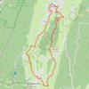
B12 A la découverte des deux villages, départ Autr

France > Auvergne-Rhône-Alpes > Isère > Autrans-Méaudre en Vercors > Autrans > Le Cornet

Distance: 16.2 Km • Elevation gain: 344 m • Maximum elevation: 1,193 m

Other places

Gear up for your next adventure:

🔥Compact Camping Stoves - Fast-boil stoves for trail-side meals and coffee
📚Travel Books Ireland - Best travel books for Irish exploration
🦺Outdoor Safety Vests - Increase visibility and safety
📦Gear Organizers - Organize outdoor equipment
🧭Route Planning Books - Plan the best hiking routes

As an Amazon Associate, this site earns from qualifying purchases at no extra cost to you.