Import a GPX file

Marks Garrison trails

Click on a trail to view its statistics, map and profile.
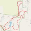
Rock House Reservation via eastern Outer Loop, Fullan Trail, Summit Loop & Fire Road

United States > Massachusetts > Worcester County > West Brookfield > Marks Garrison

Rock House Reservation, West Brookfield, Massachusetts

Distance: 3.5 Km • Elevation gain: 89 m • Maximum elevation: 311 m

Gear up for your next adventure:

🔦Everyday Carry Torches - Reliable backup light for your hiking pack
💧Portable Water Filters - Safe drinking water from streams and lakes
🧯Campfire Safety Gear - Gear to safely manage fires
🥾Women's Waterproof Boots - Gore-Tex protection for trail and mountain walking
🚨High-Decibel Whistles - Standard safety gear for mountain signaling

As an Amazon Associate, this site earns from qualifying purchases at no extra cost to you.