Import a GPX file

60km trails

Click on a trail to view its statistics, map and profile.
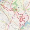
Rota da Mamoa 2024 60km

Portugal > Aveiro > Aveiro > Fonte Nova

Distance: 56.9 Km • Elevation gain: 779 m • Maximum elevation: 81 m
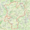
60km

Belgium > East Flanders > Oudenaarde > Zwalm > Sint-Denijs-Boekel

name=60km

Distance: 60.0 Km • Elevation gain: 481 m • Maximum elevation: 102 m

Gear up for your next adventure:

🔪Multi‑Tools & Knives - Versatile tools for outdoor tasks
🥾Lightweight Hiking Shoes - Light, breathable shoes for trail walking
📡Satellite Messengers - Emergency messaging when off‑grid
🌲Bushcraft Skills Books - Learn navigation, fire-making, and shelter building
🪓Camping Hand Axes - For processing wood during forest camping

As an Amazon Associate, this site earns from qualifying purchases at no extra cost to you.