Import a GPX file

AlberniRogers trails

Click on a trail to view its statistics, map and profile.
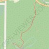
Port Alberni - Hole in the Wall

Canada > British Columbia > Alberni-Clayoquot Regional District > Area F (Cherry Creek)

Alberni Rogers Creek Woodlands. #Hiking #AlberniRogers

Distance: 1.4 Km • Elevation gain: 50 m • Maximum elevation: 160 m

Gear up for your next adventure:

📍Trail Markers & GPS - Tools to track and mark trails
⌚Solar Multisport Watches - Advanced mapping and GPS tracking for endurance hikers
🧤Thermal Outdoor Gloves - Windproof and waterproof gloves for winter hiking
🔭Laser Distance Meters - Professional precision measuring for site surveys
🔋Rechargeable Batteries - Eco-friendly power for headlamps and GPS units

As an Amazon Associate, this site earns from qualifying purchases at no extra cost to you.