Import a GPX file

Balade entre Haspelschiedt et Roppeviller trails

Click on a trail to view its statistics, map and profile.
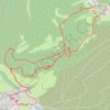
Balade entre Haspelschiedt et Roppeviller

France > Grand Est > Moselle > Haspelschiedt

Distance: 9.3 Km • Elevation gain: 272 m • Maximum elevation: 396 m

Gear up for your next adventure:

🧿Weather Radios - Track weather in remote places
🕶️Polarized Sunglasses - Reduce glare from lakes and sea cliffs
📚Irish Walking Guides - The best mapped trails in Wicklow, Kerry, and Connemara
🧺Quick-Dry Hiking Towels - Space-saving towels for wild swimming or camping
🏕️Camping Chairs - Comfortable outdoor chairs for campsites

As an Amazon Associate, this site earns from qualifying purchases at no extra cost to you.