Import a GPX file

CRHT trails

Click on a trail to view its statistics, map and profile.

California Riding and Hiking Trail (CRHT)

United States > California > San Bernardino County

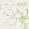
Hike on the California Riding and Hiking Trail (CRHT) through the Joshua Tree National Park. #Hiking #Nature #Desert #Park #Mountain #CRHT

Distance: 58.6 Km • Elevation gain: 943 m • Maximum elevation: 1,578 m

Gear up for your next adventure:

🧶Camping String Lights - Ambience and utility lighting
🧤Touchscreen Glove Liners - Use your mapping app without freezing your hands
🎒Day Packs - Perfect packs for day trips
🌲Bushcraft Skills Books - Learn navigation, fire-making, and shelter building
🧴Hiking Sunscreen - Sun protection for long exposure

As an Amazon Associate, this site earns from qualifying purchases at no extra cost to you.