
Coutryside trails
Click on a trail to view its statistics, map and profile.
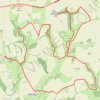
East Riding of Yorkshire Trail Running
United Kingdom > England > East Riding of Yorkshire > Millington > Givendale
Loop run / hike from Givendale via Whitekeld Beck, Deep Dale, Millington Dale, Nettle Dale, Frendal Dale, Fenstone Quarries, Keasey Dale, Carden Dale, Coldwold Farm, Warren Farm, Wan Dale, Millington and Little Givendale Farm. #Running #Hiking #Loop #Coutryside #Nature #River #Forest
Distance: 30.1 Km • Elevation gain: 736 m • Maximum elevation: 239 m