Import a GPX file

EastKiewa trails

Click on a trail to view its statistics, map and profile.

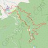
East Kiewa River Trail - Bogong Railhead Track

Australia > Victoria > Mount Beauty

Alpine National Park. #MTB #Loop #EastKiewa #Alpine

Distance: 35.5 Km • Elevation gain: 1,336 m • Maximum elevation: 707 m

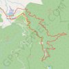
East Kiewa Valley - Mount Beauty

Australia > Victoria > Mount Beauty

#MTB #Loop #EastKiewa

Distance: 37.1 Km • Elevation gain: 1,339 m • Maximum elevation: 720 m

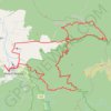
East Kiewa Valley

Australia > Victoria > Mount Beauty

#MTB #Loop #EastKiewa

Distance: 70.4 Km • Elevation gain: 2,980 m • Maximum elevation: 1,200 m

Gear up for your next adventure:

📦Outdoor Storage Bags - Keep gear organized and dry
🧶Camping String Lights - Ambience and utility lighting
🗺️Topographic Maps - Detailed maps for hiking, cycling and planning routes
🥾Mountaineering Boots - Heavy‑duty boots for rugged peaks
🍴Camp Kitchen Kits - Lightweight nesting pots and pans for backpacking

As an Amazon Associate, this site earns from qualifying purchases at no extra cost to you.