Import a GPX file

Fanny trails

Click on a trail to view its statistics, map and profile.
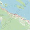
Nanaimo - Fanny Bay

Canada > British Columbia > Regional District of Nanaimo > Nanaimo

Vancouver Island. #Bike #Nanaimo #Fanny #Vancouver

Distance: 72.4 Km • Elevation gain: 664 m • Maximum elevation: 123 m

Pacific Rim National Park - Fanny Bay

Canada > British Columbia > Alberni-Clayoquot Regional District > Area C (Long Beach)

Vancouver Island. #Bike #PacificRim #Vancouver #Pacific

Distance: 93.7 Km • Elevation gain: 1,359 m • Maximum elevation: 257 m
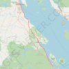
Fanny Bay - Campbell River

Canada > British Columbia > Comox Valley Regional District > Area A (Baynes Sound)

Vancouver Island. #Bike #Fanny #Campbell #Vancouver

Distance: 79.1 Km • Elevation gain: 452 m • Maximum elevation: 93 m

Gear up for your next adventure:

🔋Lithium Batteries - Best performance for digital devices in cold weather
🧗Rock Climbing Gear - Essentials for the cliffs of Moher or Gap of Dunloe
🩴Trail Running Shoes - Fast, grippy shoes for trail runs
🔌Fast Car Chargers - Recharge GPS and phones between trailheads
🔪Multi‑Tools & Knives - Versatile tools for outdoor tasks

As an Amazon Associate, this site earns from qualifying purchases at no extra cost to you.