Import a GPX file

GlenRock trails

Click on a trail to view its statistics, map and profile.
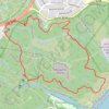
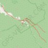
Glenrock State Conservation Area Loop

Australia > New South Wales > Newcastle

Glenrock State Conservation Area. #Hiking #Loop #Glenrock

Distance: 6.5 Km • Elevation gain: 174 m • Maximum elevation: 108 m

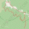
Glen Rock State Forest - Table Top

Australia > Queensland

#MTB #GlenRock

Distance: 24.5 Km • Elevation gain: 679 m • Maximum elevation: 796 m

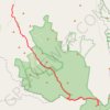
Glen Rock Bottom Yards Loop Track

Australia > Queensland

Glen Rock State Forest. #MTB #Loop #GlenRock

Distance: 19.0 Km • Elevation gain: 828 m • Maximum elevation: 882 m

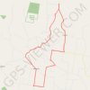
Glen Rock State Forest

Australia > Queensland

#MTB #GlenRock

Distance: 38.4 Km • Elevation gain: 383 m • Maximum elevation: 1,048 m

Mondure to Windera Park

Australia > Queensland

Mondure, Silverleaf, Warnung, Cloyna, Kitoba, Windera, Glenrock

Distance: 55.8 Km • Elevation gain: 324 m • Maximum elevation: 307 m

Gear up for your next adventure:

🛰️Handheld GPS Units - Professional satellite navigation for Irish highlands
⛺Emergency Bivvy Bags - Life-saving heat-reflective shelter for emergencies
🛶Inflatable Touring Kayaks - Explore Irish loughs and coastal topography
🧤Touchscreen Glove Liners - Use your mapping app without freezing your hands
🔦High-Lumen Headlamps - Hands-free lighting for early starts or late finishes

As an Amazon Associate, this site earns from qualifying purchases at no extra cost to you.