
Green field park trails
Click on a trail to view its statistics, map and profile.
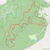
Pisgah National Forest Run Loop
United States > North Carolina > Buncombe County > Bent Creek
Loop run / trail / hike from Rice Pinnacle Parking via Wolf Branch Trail, Ingles Fields Gap, Little Hickory Top, Sidehill Trail, Greens Lick Trail, North Boundary Road, Wolf Knob, Mease Gap, Moors Gap, Corvair Trail and Deer Lake Road in the Pisgah National Forest. #Running #Trail #Hiking #Loop #Forest #Nature
Distance: 23.1 Km • Elevation gain: 907 m • Maximum elevation: 1,015 m
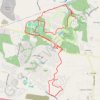
Patriot's Park Loop
United States > Georgia > Columbia County
Starting at Patriot’s Park in Grovetown, this loop begins among recreation fields, ponds, and wooded park edges before joining the Bartram Bike and Walk Trail for a first circuit around the Bartram Trail neighborhood, its residential green spaces, and the golf-course landscape. It then connects with the…
Distance: 21.0 Km • Elevation gain: 224 m • Maximum elevation: 128 m

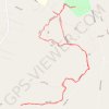
Indian Bar Camp via Summerland Trail, Wonderland Trail and Panhandle Gap
United States > Washington > Pierce County
This hike to Indian Bar offers a remarkable journey through some of Mount Rainier National Park's most diverse landscapes. Beginning with shaded forests and gradually opening into the expansive meadows of Summerland, the trail rewards hikers with views of cascading waterfalls, wildflower fields, rugged…
Distance: 14.0 Km • Elevation gain: 1,007 m • Maximum elevation: 2,065 m
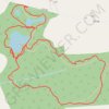
Green field park
Distance: 3.1 Km • Elevation gain: 21 m • Maximum elevation: 118 m