Import a GPX file

Kains trails

Click on a trail to view its statistics, map and profile.

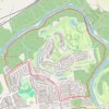
Thames Valley Trail Loop

Canada > Ontario > London

Thames River. Kains Woods. #Hiking #Running #Kains

Distance: 6.9 Km • Elevation gain: 96 m • Maximum elevation: 271 m

Gear up for your next adventure:

🧯Camp Safety Kits - All‑in‑one safety gear
🎁Outdoor Gift Ideas - Great gifts for adventurers
🌄Sun Protection Gear - Gear to shield from strong sun
🛡️Protective Bike Gear - Helmets & pads for safe rides
🎒Waterproof Backpacks - Protect your gear from rain on Irish hikes

As an Amazon Associate, this site earns from qualifying purchases at no extra cost to you.