Import a GPX file

Le Cornet trails

Click on a trail to view its statistics, map and profile.
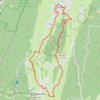
B12 A la découverte des deux villages, départ Autr

France > Auvergne-Rhône-Alpes > Isère > Autrans-Méaudre en Vercors > Autrans > Le Cornet

Distance: 16.2 Km • Elevation gain: 344 m • Maximum elevation: 1,193 m

Gear up for your next adventure:

🧺Quick-Dry Hiking Towels - Space-saving towels for wild swimming or camping
🔗Locking Carabiners - Secure gear to your pack or for light climbing
🥛Insulated Flasks - Keep drinks hot or cold
🍴Camp Kitchen Kits - Lightweight nesting pots and pans for backpacking
🎒Technical Hiking Daypacks - Ergonomic backpacks with hydration bladder compatibility

As an Amazon Associate, this site earns from qualifying purchases at no extra cost to you.