Import a GPX file

Le Fouilly trails

Click on a trail to view its statistics, map and profile.
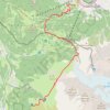
Day 01: Les Houches to Auberge du Truc

France > Auvergne-Rhône-Alpes > Upper Savoy > Les Houches > Le Fouilly

Distance: 14.1 Km • Elevation gain: 1,480 m • Maximum elevation: 2,117 m

Gear up for your next adventure:

🧯Camp Safety Kits - All‑in‑one safety gear
🧴Hiking Sunscreen - Sun protection for long exposure
📍Handheld GPS Devices - Accurate GPS units for mapping and navigation
🚲Cycling GPS Computers - Topographic mapping for Irish road and mountain biking
🔋Portable Power Banks - Keep devices charged on long trips

As an Amazon Associate, this site earns from qualifying purchases at no extra cost to you.