Import a GPX file

Mallorytown trails

Click on a trail to view its statistics, map and profile.

Gander - Mallorytown

Canada > Newfoundland and Labrador > Gander

#Bike #Gander #Mallorytown #Newfoundland

Distance: 101.3 Km • Elevation gain: 882 m • Maximum elevation: 146 m
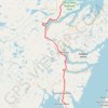
Mallorytown - Arnold's Cove

Canada > Newfoundland and Labrador

#Bike #Mallorytown #ArnoldsCove #Newfoundland

Distance: 118.7 Km • Elevation gain: 1,182 m • Maximum elevation: 149 m

Gear up for your next adventure:

🧤Touchscreen Glove Liners - Use your mapping app without freezing your hands
👣Waterproof Leg Gaiters - Keep bog water and debris out of your boots
🪓Camping Hand Axes - For processing wood during forest camping
🛸Lightweight Camera Drones - Capture stunning aerial topographic views of the landscape
⌚Solar Multisport Watches - Advanced mapping and GPS tracking for endurance hikers

As an Amazon Associate, this site earns from qualifying purchases at no extra cost to you.