Import a GPX file

Mont Blanc par les Grands Mulets trails

Click on a trail to view its statistics, map and profile.
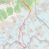
Mont Blanc par les Grands Mulets

France > Auvergne-Rhône-Alpes > Upper Savoy > Chamonix-Mont-Blanc > Les Bossons

Distance: 25.6 Km • Elevation gain: 3,832 m • Maximum elevation: 4,799 m

Gear up for your next adventure:

🚰Hydration Packs - Hands‑free water storage for hikers
🛶Waterproof Dry Bags - Keep electronics and clothes dry during wet treks
🥽UV Protection Sunglasses - Protect eyes on bright days
🪶Ultralight Tents - Lightweight shelters for hikers
📱Rugged Smartphones - Waterproof phones with long battery for offline mapping

As an Amazon Associate, this site earns from qualifying purchases at no extra cost to you.