Import a GPX file

Namadgi trails

Click on a trail to view its statistics, map and profile.

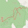
Mount Tennent - Boroomba rocks

Australia

Namadgi National Park. #Hiking #Loop #Namadgi

Distance: 39.2 Km • Elevation gain: 1,938 m • Maximum elevation: 1,388 m

Gear up for your next adventure:

📊Altimeters & Barometers - Track elevation and weather changes
🌂Windproof Trekking Umbrellas - Protection during vertical Irish rain
🔪Multi‑Tools & Knives - Versatile tools for outdoor tasks
🩻Outdoor Health Essentials - Necessary health items for hikes
🪢Paracord & Ropes - Strong ropes for camping and gear

As an Amazon Associate, this site earns from qualifying purchases at no extra cost to you.