Import a GPX file

SpencesBridge trails

Click on a trail to view its statistics, map and profile.
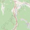
Spences Bridge - Cache Creek

Canada > British Columbia > Thompson-Nicola Regional District > Area I (Blue Sky Country) > Spences Bridge

Thompson River. #Bike #SpencesBridge #CacheCreek #Thompson

Distance: 48.8 Km • Elevation gain: 698 m • Maximum elevation: 512 m

Gear up for your next adventure:

🎁Outdoor Gift Ideas - Great gifts for adventurers
🧗Rock Climbing Gear - Essentials for the cliffs of Moher or Gap of Dunloe
🌲Survival Gear - Equipment for outdoor survival situations
🪑Compact Camping Tables - Tables for campsite comfort
🍽️Camping Utensil Sets - Complete eating sets

As an Amazon Associate, this site earns from qualifying purchases at no extra cost to you.