Import a GPX file

SproatLake trails

Click on a trail to view its statistics, map and profile.
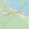
Sproat Lake - Nanaimo

Canada > British Columbia > Alberni-Clayoquot Regional District > Area D (Sproat Lake)

#Bike #SproatLake #Nanaimo

Distance: 87.0 Km • Elevation gain: 1,273 m • Maximum elevation: 422 m

Gear up for your next adventure:

🌲Bushcraft Skills Books - Learn navigation, fire-making, and shelter building
🍖High-Protein Trail Snacks - Lightweight fuel for long distance treks
🔌Fast Car Chargers - Recharge GPS and phones between trailheads
🔋Portable Power Banks - Keep devices charged on long trips
🔥Camping Stoves - Portable camping stoves for outdoor cooking

As an Amazon Associate, this site earns from qualifying purchases at no extra cost to you.