Import a GPX file

UTMB 2020 trails

Click on a trail to view its statistics, map and profile.
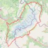
UTMB 2020

France > Auvergne-Rhône-Alpes > Upper Savoy > Chamonix-Mont-Blanc > Les Bossons

Total: 171.3km

Distance: 168.1 Km • Elevation gain: 10,526 m • Maximum elevation: 2,574 m

Gear up for your next adventure:

🗺️Topographic Maps - Detailed maps for hiking, cycling and planning routes
🧗Climbing Gear - Essential equipment for climbing routes
📡Satellite Messengers - Emergency messaging when off‑grid
⌚Solar Multisport Watches - Advanced mapping and GPS tracking for endurance hikers
🍽️Camping Utensil Sets - Complete eating sets

As an Amazon Associate, this site earns from qualifying purchases at no extra cost to you.