Import a GPX file

Valire trails

Click on a trail to view its statistics, map and profile.
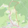
Valire

Belgium > Luxembourg > Bastogne > Wibrin

Distance: 4.5 Km • Elevation gain: 107 m • Maximum elevation: 463 m
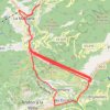
Túnel de les dos valires

Andorra > Ordino

Distance: 105.0 Km • Elevation gain: 10,829 m • Maximum elevation: 1,736 m

Gear up for your next adventure:

👣Waterproof Leg Gaiters - Keep bog water and debris out of your boots
🧦Merino Wool Socks - Moisture-wicking and blister-preventing trail socks
⛺Emergency Bivvy Bags - Life-saving heat-reflective shelter for emergencies
🔨Multi-tool Devices - Versatile tools for gear repairs in the field
📚Travel Books Ireland - Best travel books for Irish exploration

As an Amazon Associate, this site earns from qualifying purchases at no extra cost to you.