Import a GPX file

Wilmot trails

Click on a trail to view its statistics, map and profile.
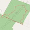
Langenau Forest Loop Trail

United States > New Hampshire > Merrimack County > Wilmot

Distance: 4.3 Km • Elevation gain: 114 m • Maximum elevation: 471 m

Digby - Wilmot

Canada > Nova Scotia > Digby County > Town of Digby

Annapolis Basin. #Bike #Digby #Wilmot #Annapolis

Distance: 83.2 Km • Elevation gain: 658 m • Maximum elevation: 63 m

Kearsarge Klassic 55 from Pleasant Lake

United States > New Hampshire > Merrimack County > New London > Elkins

Around Mount Kearsarge Klassic route

Distance: 91.8 Km • Elevation gain: 1,446 m • Maximum elevation: 473 m

Wilmot - Falmouth

Canada > Nova Scotia > Municipality of the County of Annapolis > Wilmot

#Bike #Wilmot #Falmouth

Distance: 90.5 Km • Elevation gain: 622 m • Maximum elevation: 63 m

Gear up for your next adventure:

🛰️Handheld GPS Units - Professional satellite navigation for Irish highlands
🧗Rock Climbing Gear - Essentials for the cliffs of Moher or Gap of Dunloe
💡Hiking Headlamps - Hands‑free lights for night hikes
👖Zip-off Hiking Pants - Adapt to changing Irish temperatures quickly
🧦Merino Wool Socks - Moisture-wicking and blister-preventing trail socks

As an Amazon Associate, this site earns from qualifying purchases at no extra cost to you.