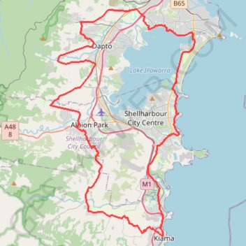
Southern Illawarra Circuit
Interactive trail map
Trail profile
- Distance: 82.6 Km
- Elevation gain: 802 m
- Maximum elevation: 140 m
- Elevation loss: 802 m
- Minimum elevation: 0 m
About this trail
Name: Southern Illawarra Circuit trail, distance, elevation, map, profile, GPS track
Coordinates: -34.67045 150.73397 -34.46878 150.88892
Other hiking, mountain biking, running and outdoor activity trails
Click on a trail to view its statistics, map and profile.
Ulladulla - Minnamurra
Australia > New South Wales > Burrill Lake
#Bike
Distance: 127.8 Km • Elevation gain: 1,627 m • Maximum elevation: 143 m
Kiama Coast Walk
Australia > New South Wales > Minnamurra
Distance: 19.8 Km • Elevation gain: 468 m • Maximum elevation: 49 m