Import a GPX file

Mesa to Tempe Town Lake via stadium connector path

  • Distance: 14.1 Km
  • Elevation gain: 44 m
  • Maximum elevation: 388 m
  • Elevation loss: 76 m
  • Minimum elevation: 347 m

Interactive trail map

Trail profile

  • Distance: 14.1 Km
  • Elevation gain: 44 m
  • Maximum elevation: 388 m
  • Elevation loss: 76 m
  • Minimum elevation: 347 m

About this trail
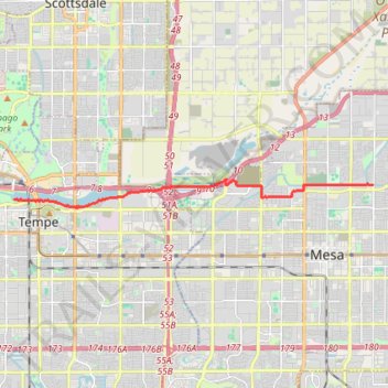
Name: Mesa to Tempe Town Lake via stadium connector path trail, distance, elevation, map, profile, GPS track

Start: Sun Circle Trail, Hohokam Village, Mesa, Maricopa County, Arizona, 85203, United States (33.43699 -111.81413)

End: Elmore Pedestrian Bridge, Tempe, Maricopa County, Arizona, 85281, United States (33.43242 -111.94890)

Coordinates: 33.42979 -111.94893 33.43870 -111.81413

Gear up for your next adventure:

🛡️Protective Bike Gear - Helmets & pads for safe rides
🚰Hydration Packs - Hands‑free water storage for hikers
🏃‍♀️Running Hydration Belts - Hydration on the go for runners
🔒Outdoor Gear Locks - Secure your equipment
🖼️Vintage Irish Map Prints - Decorative wall art for map lovers and geographers

As an Amazon Associate, this site earns from qualifying purchases at no extra cost to you.