
Sperati Point via Achenbach Trail in Theodore Roosevelt National Park
The hike to Sperati Point offers a unique blend of tranquility and impressive views. Starting from the Oxbow Overlook, the trail gently winds through open prairie, revealing sweeping vistas of the Little Missouri River, rugged badlands, and surrounding grasslands. As hikers reach Sperati Point, they are rewarded with panoramic scenes of colorful river bends and dramatic, weathered rock formations, making this short hike an ideal way to experience the North Unit’s diverse landscape without heavy crowds #Hiking #Overlook #Nature
- Distance: 3.8 Km
- Elevation gain: 85 m
- Maximum elevation: 774 m
- Elevation loss: 84 m
- Minimum elevation: 720 m
- Moving time: 46 m 48 s
- Moving speed: 4.9 Km/h
- Maximum speed: 10.7 Km/h
- Total time: 47 m 34 s
- Global speed: 4.8 Km/h
Interactive trail map
Trail profile
- Distance: 3.8 Km
- Elevation gain: 85 m
- Maximum elevation: 774 m
- Elevation loss: 84 m
- Minimum elevation: 720 m
- Moving time: 46 m 48 s
- Moving speed: 4.9 Km/h
- Maximum speed: 10.7 Km/h
- Total time: 47 m 34 s
- Global speed: 4.8 Km/h
About this trail
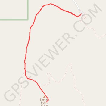
Name: Sperati Point via Achenbach Trail in Theodore Roosevelt National Park trail, distance, elevation, map, profile, GPS track
Start: Achenbach Trail, McKenzie County, North Dakota, United States (47.60313 -103.44234)
End: Oxbow Overlook Trail, McKenzie County, North Dakota, United States (47.60334 -103.44213)
Coordinates: 47.59355 -103.45144 47.60440 -103.44213