Import a GPX file

Whiting Ranch Wilderness Park

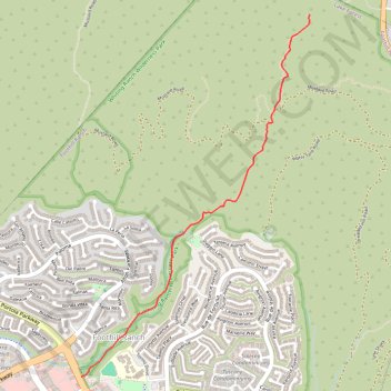
Hike from Foothill Ranch through Whiting Ranch Wilderness Park via Borrego Canyon Trail and Red Rock Canyon Trail. #Hiking #Canyon #Nature #Forest #Park

  • Distance: 3.4 Km
  • Elevation gain: 170 m
  • Maximum elevation: 396 m
  • Elevation loss: 22 m
  • Minimum elevation: 248 m

Interactive trail map

Trail profile

  • Distance: 3.4 Km
  • Elevation gain: 170 m
  • Maximum elevation: 396 m
  • Elevation loss: 22 m
  • Minimum elevation: 248 m

About this trail
Gear up for your next adventure:

🧊Winter Boot Traction - Grip for icy paths in the Mourne or Derryveagh mountains
🥛Insulated Flasks - Keep drinks hot or cold
🛸Lightweight Camera Drones - Capture stunning aerial topographic views of the landscape
🔌Fast Car Chargers - Recharge GPS and phones between trailheads
🧥Packable Down Jackets - High warmth-to-weight ratio for summit breaks

As an Amazon Associate, this site earns from qualifying purchases at no extra cost to you.