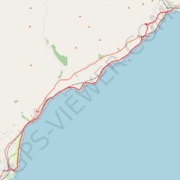
John O'Groats Trail - Brora to Helmsdale
- Distance: 21.3 Km
- Elevation gain: 249 m
- Maximum elevation: 100 m
- Elevation loss: 255 m
- Minimum elevation: 0 m
- Moving time: 5 h 35 m
- Moving speed: 3.8 Km/h
- Maximum speed: 6.6 Km/h
- Total time: 6 h 25 m
- Global speed: 3.3 Km/h
Interactive trail map
Trail profile
- Distance: 21.3 Km
- Elevation gain: 249 m
- Maximum elevation: 100 m
- Elevation loss: 255 m
- Minimum elevation: 0 m
- Moving time: 5 h 35 m
- Moving speed: 3.8 Km/h
- Maximum speed: 6.6 Km/h
- Total time: 6 h 25 m
- Global speed: 3.3 Km/h
About this trail
Name: John O'Groats Trail - Brora to Helmsdale trail, distance, elevation, map, profile, GPS track
Coordinates: 58.01074 -3.85498 58.11610 -3.65085
Other hiking, mountain biking, running and outdoor activity trails
Click on a trail to view its statistics, map and profile.
John O'Groats Trail - Helmsdale to Berriedale
United Kingdom > Scotland > Highland > Helmsdale
Distance: 17.6 Km • Elevation gain: 811 m • Maximum elevation: 213 m
Dunbeath - Dornoch
United Kingdom > Scotland > Highland > Houstry
Distance: 72.9 Km • Elevation gain: 898 m • Maximum elevation: 230 m