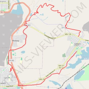
Side by Side ride around the Iron Range using the OHV Trails
- Distance: 22.6 Km
- Elevation gain: 270 m
- Maximum elevation: 543 m
- Elevation loss: 288 m
- Minimum elevation: 451 m
- Moving time: 1 h 14 m
- Moving speed: 18.2 Km/h
- Maximum speed: 61.1 Km/h
- Total time: 1 h 25 m
- Global speed: 16.0 Km/h
Interactive trail map
Trail profile
- Distance: 22.6 Km
- Elevation gain: 270 m
- Maximum elevation: 543 m
- Elevation loss: 288 m
- Minimum elevation: 451 m
- Moving time: 1 h 14 m
- Moving speed: 18.2 Km/h
- Maximum speed: 61.1 Km/h
- Total time: 1 h 25 m
- Global speed: 16.0 Km/h
About this trail
Name: Side by Side ride around the Iron Range using the OHV Trails trail, distance, elevation, map, profile, GPS track
Coordinates: 47.46111 -92.53320 47.51582 -92.46208