
Mount Walker hike in Olympic National Forest
- Distance: 8.8 Km
- Elevation gain: 623 m
- Maximum elevation: 840 m
- Elevation loss: 629 m
- Minimum elevation: 255 m
- Moving time: 2 h 43 m
- Moving speed: 3.2 Km/h
- Maximum speed: 5.9 Km/h
- Total time: 3 h 32 m
- Global speed: 2.5 Km/h
Interactive trail map
Trail profile
- Distance: 8.8 Km
- Elevation gain: 623 m
- Maximum elevation: 840 m
- Elevation loss: 629 m
- Minimum elevation: 255 m
- Moving time: 2 h 43 m
- Moving speed: 3.2 Km/h
- Maximum speed: 5.9 Km/h
- Total time: 3 h 32 m
- Global speed: 2.5 Km/h
About this trail
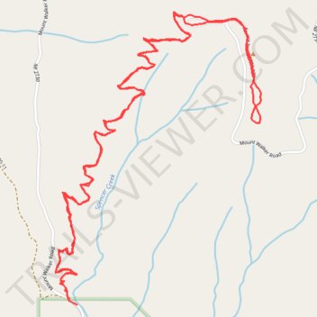
Name: Mount Walker hike in Olympic National Forest trail, distance, elevation, map, profile, GPS track
Start: Mount Walker Road, Jefferson County, Washington, 98376, United States (47.77592 -122.91394)
End: Mount Walker Road, Jefferson County, Washington, 98376, United States (47.77560 -122.91340)
Coordinates: 47.77560 -122.91485 47.78890 -122.90099