Draper Suspension Bridge Loop via Orson Smith Trail, Aqueduct Trail and Bonneville Shoreline Trail
The Draper Suspension Bridge Loop offers a captivating hike through diverse landscapes. As you traverse the Orson Smith, Aqueduct, and Bonneville Shoreline Trails, you'll encounter scenic views of the Wasatch Mountains, Salt Lake Valley, and Bear Canyon, especially while crossing the impressive 185-foot suspension bridge that spans the canyon. #Hiking #Mountain #Loop #Nature #Canyon #Overlook
- Distance: 3.2 Km
- Elevation gain: 161 m
- Maximum elevation: 1,598 m
- Elevation loss: 161 m
- Minimum elevation: 1,470 m
- Moving time: 1 h 5 m
- Moving speed: 2.9 Km/h
- Maximum speed: 4.9 Km/h
- Total time: 1 h 18 m
- Global speed: 2.5 Km/h
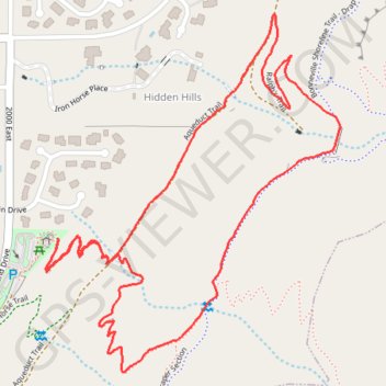
Interactive trail map
Trail profile
- Distance: 3.2 Km
- Elevation gain: 161 m
- Maximum elevation: 1,598 m
- Elevation loss: 161 m
- Minimum elevation: 1,470 m
- Moving time: 1 h 5 m
- Moving speed: 2.9 Km/h
- Maximum speed: 4.9 Km/h
- Total time: 1 h 18 m
- Global speed: 2.5 Km/h
About this trail
Name: Draper Suspension Bridge Loop via Orson Smith Trail, Aqueduct Trail and Bonneville Shoreline Trail trail, distance, elevation, map, profile, GPS track
Coordinates: 40.51967 -111.83339 40.52651 -111.82598