Import a GPX file

Valire trails

Click on a trail to view its statistics, map and profile.
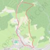
Valire

Belgium > Luxembourg > Bastogne > Wibrin

Distance: 4.5 Km • Elevation gain: 107 m • Maximum elevation: 463 m
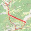
Túnel de les dos valires

Andorra > Ordino

Distance: 105.0 Km • Elevation gain: 10,829 m • Maximum elevation: 1,736 m

Gear up for your next adventure:

🧥Waterproof Hiking Jackets - Rain jackets for unpredictable weather
🛶Waterproof Dry Bags - Keep electronics and clothes dry during wet treks
🥛Insulated Flasks - Keep drinks hot or cold
🛡️Protective Bike Gear - Helmets & pads for safe rides
🧗Climbing Gear - Essential equipment for climbing routes

As an Amazon Associate, this site earns from qualifying purchases at no extra cost to you.