Import a GPX file

Beryl Gaffney Park

Rideau River. Jock River. #Hiking #Running

  • Distance: 7.0 Km
  • Elevation gain: 61 m
  • Maximum elevation: 91 m
  • Elevation loss: 61 m
  • Minimum elevation: 78 m

Interactive trail map

Trail profile

  • Distance: 7.0 Km
  • Elevation gain: 61 m
  • Maximum elevation: 91 m
  • Elevation loss: 61 m
  • Minimum elevation: 78 m

About this trail

Other hiking, mountain biking, running and outdoor activity trails

Click on a trail to view its statistics, map and profile.
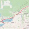
Québec - Montréal - Saint-Laurent River - Lake Ontario - Niagara Falls

Canada > Quebec > Urban agglomeration of Québec > Quebec

#Bike #Ontario

Distance: 1,078.4 Km • Elevation gain: 4,804 m • Maximum elevation: 209 m

Brockville - Ottawa

Canada > Ontario > Brockville > Brockville

#Bike #Brockville #Ottawa

Distance: 118.4 Km • Elevation gain: 375 m • Maximum elevation: 134 m

Gear up for your next adventure:

🔋Rechargeable Batteries - Eco-friendly power for headlamps and GPS units
💳Travel Cards for Ireland - Convenient payment abroad
📈Fitness Trackers - Monitor activity and hike metrics
🧗Rock Climbing Gear - Essentials for the cliffs of Moher or Gap of Dunloe
🩹First Aid Kits - Essential kits for outdoor safety

As an Amazon Associate, this site earns from qualifying purchases at no extra cost to you.