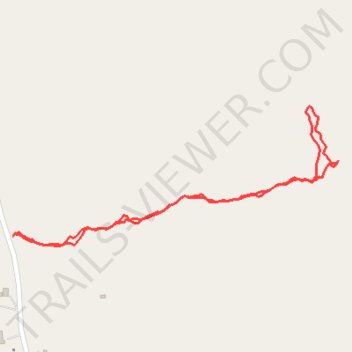
Cnoc Leitir Móir
- Distance: 1.4 Km
- Elevation gain: 91 m
- Maximum elevation: 113 m
- Elevation loss: 92 m
- Minimum elevation: 26 m
- Moving time: 28 m 29 s
- Moving speed: 3.0 Km/h
- Maximum speed: 8.3 Km/h
- Total time: 32 m 57 s
- Global speed: 2.6 Km/h
Interactive trail map
Trail profile
- Distance: 1.4 Km
- Elevation gain: 91 m
- Maximum elevation: 113 m
- Elevation loss: 92 m
- Minimum elevation: 26 m
- Moving time: 28 m 29 s
- Moving speed: 3.0 Km/h
- Maximum speed: 8.3 Km/h
- Total time: 32 m 57 s
- Global speed: 2.6 Km/h
About this trail
Name: Cnoc Leitir Móir trail, distance, elevation, map, profile, GPS track
Coordinates: 53.29497 -9.67118 53.29701 -9.66325
Topography: County Galway topographic map, elevation, terrain