Clarinbridge trails in Kilcornan Forest
- Distance: 7.6 Km
- Elevation gain: 51 m
- Maximum elevation: 27 m
- Elevation loss: 51 m
- Minimum elevation: 4 m
- Moving time: 1 h 54 m
- Moving speed: 4.0 Km/h
- Maximum speed: 7.5 Km/h
- Total time: 2 h 11 m
- Global speed: 3.5 Km/h
Interactive trail map
Trail profile
- Distance: 7.6 Km
- Elevation gain: 51 m
- Maximum elevation: 27 m
- Elevation loss: 51 m
- Minimum elevation: 4 m
- Moving time: 1 h 54 m
- Moving speed: 4.0 Km/h
- Maximum speed: 7.5 Km/h
- Total time: 2 h 11 m
- Global speed: 3.5 Km/h
About this trail
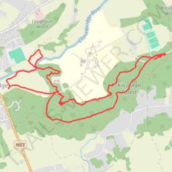
Name: Clarinbridge trails in Kilcornan Forest trail, distance, elevation, map, profile, GPS track
Coordinates: 53.22355 -8.87732 53.23165 -8.84776
Topography: County Galway topographic map, elevation, terrain