
Mosaic Canyon Trail in Death Valley National Park
The Mosaic Canyon Trail in Death Valley National Park offers a fascinating experience with its unique geological features and striking desert beauty. As you traverse this trail, you'll encounter narrow, polished canyon walls of marble, revealing a smooth texture that has been sculpted by ancient flash floods. The hike features sections of colorful rock formations, particularly the mosaic-like breccia, and winding slot canyons that provide an otherworldly atmosphere. While some portions of the trail are challenging due to slippery surfaces and rocky obstacles, the reward is an up-close view of the dramatic desert landscape that makes this one of the park's most memorable hikes. #Hiking #Canyon #Desert #Rock #Nature
- Distance: 6.9 Km
- Elevation gain: 474 m
- Maximum elevation: 642 m
- Elevation loss: 496 m
- Minimum elevation: 283 m
Interactive trail map
Trail profile
- Distance: 6.9 Km
- Elevation gain: 474 m
- Maximum elevation: 642 m
- Elevation loss: 496 m
- Minimum elevation: 283 m
About this trail
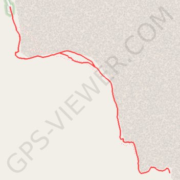
Name: Mosaic Canyon Trail in Death Valley National Park trail, distance, elevation, map, profile, GPS track
Start: Mosaic Canyon Trail, Inyo County, California, United States (36.57011 -117.14356)
End: Mosaic Canyon Road, Stovepipe Wells, Inyo County, California, United States (36.57225 -117.14435)
Coordinates: 36.55796 -117.14435 36.57225 -117.12726