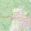
Sophia Doyle Reserve
#Hiking #Loop #SophiaDoyle #Sydney
- Distance: 6.8 Km
- Elevation gain: 52 m
- Maximum elevation: 111 m
- Elevation loss: 76 m
- Minimum elevation: 51 m
Interactive trail map
Trail profile
- Distance: 6.8 Km
- Elevation gain: 52 m
- Maximum elevation: 111 m
- Elevation loss: 76 m
- Minimum elevation: 51 m
About this trail

Name: Sophia Doyle Reserve trail, distance, elevation, map, profile, GPS track
Coordinates: -33.75999 150.96488 -33.73917 150.98641
Other hiking, mountain biking, running and outdoor activity trails
Click on a trail to view its statistics, map and profile.