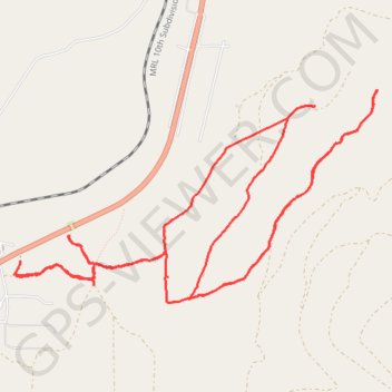
Schley
- Distance: 12.8 Km
- Elevation gain: 261 m
- Maximum elevation: 1,350 m
- Elevation loss: 262 m
- Minimum elevation: 1,190 m
- Moving time: 1 h 31 m
- Moving speed: 8.4 Km/h
- Maximum speed: 41.2 Km/h
- Total time: 1 h 35 m
- Global speed: 8.0 Km/h
Interactive trail map
Trail profile
- Distance: 12.8 Km
- Elevation gain: 261 m
- Maximum elevation: 1,350 m
- Elevation loss: 262 m
- Minimum elevation: 1,190 m
- Moving time: 1 h 31 m
- Moving speed: 8.4 Km/h
- Maximum speed: 41.2 Km/h
- Total time: 1 h 35 m
- Global speed: 8.0 Km/h
About this trail
Name: Schley trail, distance, elevation, map, profile, GPS track
Start: F-2020, Missoula County, Montana, United States (47.07080 -114.05937)
End: F-2020, Missoula County, Montana, United States (47.07086 -114.05948)
Coordinates: 47.06898 -114.05948 47.08355 -114.02309
Other hiking, mountain biking, running and outdoor activity trails
Click on a trail to view its statistics, map and profile.
Bike ride on the slopes of Charity Peak
United States > Montana > Missoula County > Schley
Morning Ride
Distance: 16.4 Km • Elevation gain: 565 m • Maximum elevation: 1,556 m