
Wetherlam and Black Sails Loop
Loop hike from Coniston via Coniston Waterfall, Hole Rake, Lower Hows, Wetherlam, Red Dell Head Moss, Black Sails and Levers Water in the Lake District National Park. #Hiking #Loop #Nature #Mountain #Lake
- Distance: 13.6 Km
- Elevation gain: 758 m
- Maximum elevation: 757 m
- Elevation loss: 759 m
- Minimum elevation: 60 m
- Moving time: 5 h 4 m
- Moving speed: 2.7 Km/h
- Maximum speed: 6.9 Km/h
- Total time: 6 h 43 m
- Global speed: 2.0 Km/h
Interactive trail map
Trail profile
- Distance: 13.6 Km
- Elevation gain: 758 m
- Maximum elevation: 757 m
- Elevation loss: 759 m
- Minimum elevation: 60 m
- Moving time: 5 h 4 m
- Moving speed: 2.7 Km/h
- Maximum speed: 6.9 Km/h
- Total time: 6 h 43 m
- Global speed: 2.0 Km/h
About this trail
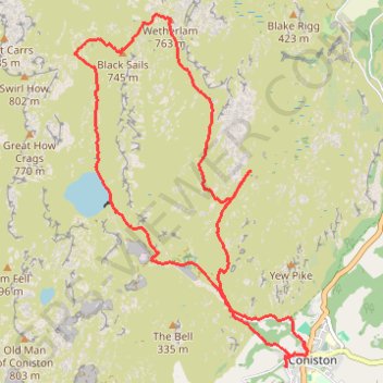
Name: Wetherlam and Black Sails Loop trail, distance, elevation, map, profile, GPS track
Coordinates: 54.36777 -3.11351 54.40093 -3.07580
Other hiking, mountain biking, running and outdoor activity trails
Click on a trail to view its statistics, map and profile.
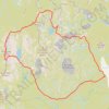
Dow Crag via South Rake
United Kingdom > England > Westmorland and Furness > Coniston
Distance: 9.7 Km • Elevation gain: 770 m • Maximum elevation: 796 m
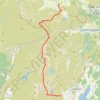
Sun Coniston to Great Langdale
United Kingdom > England > Westmorland and Furness > Coniston
Distance: 14.6 Km • Elevation gain: 999 m • Maximum elevation: 796 m
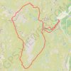
2024-05-03 16:11:23
United Kingdom > England > Westmorland and Furness > Coniston
Distance: 9.0 Km • Elevation gain: 611 m • Maximum elevation: 756 m