Import a GPX file

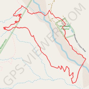
Whitewater Canyon Loop

Loop hike around the Whitewater River via the Pacific Crest Trail (PCT) and the Whitewater Canyon Road in the Sand to Snow National Monument. #Hiking #Loop #Canyon #River #Mountain #Nature #PCT

  • Distance: 5.9 Km
  • Elevation gain: 249 m
  • Maximum elevation: 842 m
  • Elevation loss: 250 m
  • Minimum elevation: 636 m

Interactive trail map

Trail profile

  • Distance: 5.9 Km
  • Elevation gain: 249 m
  • Maximum elevation: 842 m
  • Elevation loss: 250 m
  • Minimum elevation: 636 m

About this trail
Gear up for your next adventure:

🧢Waterproof Caps - Keep rain off your face and glasses while hiking
📚Irish Walking Guides - The best mapped trails in Wicklow, Kerry, and Connemara
🥾Mountaineering Boots - Heavy‑duty boots for rugged peaks
🧭Hiking Compasses - Reliable compasses for navigation off‑trail
🧤Touchscreen Glove Liners - Use your mapping app without freezing your hands

As an Amazon Associate, this site earns from qualifying purchases at no extra cost to you.