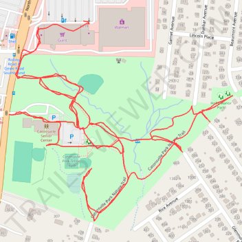
Catonsville Park
- Distance: 4.2 Km
- Elevation gain: 39 m
- Maximum elevation: 160 m
- Elevation loss: 41 m
- Minimum elevation: 147 m
- Moving time: 50 m 13 s
- Moving speed: 5.0 Km/h
- Maximum speed: 23.0 Km/h
- Total time: 50 m 13 s
- Global speed: 5.0 Km/h
Interactive trail map
Trail profile
- Distance: 4.2 Km
- Elevation gain: 39 m
- Maximum elevation: 160 m
- Elevation loss: 41 m
- Minimum elevation: 147 m
- Moving time: 50 m 13 s
- Moving speed: 5.0 Km/h
- Maximum speed: 23.0 Km/h
- Total time: 50 m 13 s
- Global speed: 5.0 Km/h
About this trail
Name: Catonsville Park trail, distance, elevation, map, profile, GPS track
Coordinates: 39.27730 -76.75452 39.28185 -76.74794