
Tracked with OSMTracker for Android™ trails
Click on a trail to view its statistics, map and profile.

Tracked with OSMTracker for Android™
Australia > Victoria > Melbourne
Citybound train
Distance: 16.2 Km • Elevation gain: 164 m • Maximum elevation: 127 m

Tracked with OSMTracker for Android™
Australia > Victoria > Melbourne
may suffer accuracy dips around lowered stations
Distance: 23.4 Km • Elevation gain: 69 m • Maximum elevation: 44 m

Tracked with OSMTracker for Android™
Australia > Victoria > Melbourne
end to end train ride
Distance: 30.7 Km • Elevation gain: 201 m • Maximum elevation: 101 m

Tracked with OSMTracker for Android™
Australia > Victoria > Melbourne
Accuracy under 4m however does suffer from multipath in Ringwood area
Distance: 14.4 Km • Elevation gain: 183 m • Maximum elevation: 137 m

Tracked with OSMTracker for Android™
Australia > Victoria > Melbourne
accuracy generally under 4m, long track for new road
Distance: 40.7 Km • Elevation gain: 110 m • Maximum elevation: 140 m

Tracked with OSMTracker for Android™
Australia > Victoria > Melbourne
east bound starts in North Coburg, ends in Bundoora, accuracy under 5m
Distance: 8.6 Km • Elevation gain: 48 m • Maximum elevation: 98 m

Tracked with OSMTracker for Android™
Australia > Victoria > Melbourne
Accuracy generally good, however may suffer from multipath in dense areas
Distance: 5.4 Km • Elevation gain: 56 m • Maximum elevation: 66 m
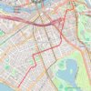
Tracked with OSMTracker for Android™
Australia > Victoria > Melbourne
Accuracy not great in Southbank area, however does get better towards end of line
Distance: 4.0 Km • Elevation gain: 27 m • Maximum elevation: 18 m

Tracked with OSMTracker for Android™
Australia > Victoria > Melbourne
Accuracy above 4m in parts, otherwise good
Distance: 12.6 Km • Elevation gain: 60 m • Maximum elevation: 30 m
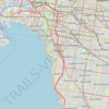
Tracked with OSMTracker for Android™
Australia > Victoria > Melbourne
Accuracy varies, under 6M though some tunneled sections
Distance: 17.2 Km • Elevation gain: 95 m • Maximum elevation: 25 m
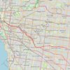
Tracked with OSMTracker for Android™
Australia > Victoria > Melbourne
accuracy varies, Includes some tunneled sections, may suffer from multipath
Distance: 20.5 Km • Elevation gain: 217 m • Maximum elevation: 131 m

Tracked with OSMTracker for Android™
Australia > Victoria > Melbourne
Accuracy varies, below 5m, bus commences from Coburg going eastbound
Distance: 11.5 Km • Elevation gain: 86 m • Maximum elevation: 98 m