Import a GPX file

Houston - Burns Lake

#Bike #Houston #Burns

  • Distance: 79.6 Km
  • Elevation gain: 760 m
  • Maximum elevation: 878 m
  • Elevation loss: 686 m
  • Minimum elevation: 600 m

Interactive trail map

Trail profile

  • Distance: 79.6 Km
  • Elevation gain: 760 m
  • Maximum elevation: 878 m
  • Elevation loss: 686 m
  • Minimum elevation: 600 m

About this trail

Other hiking, mountain biking, running and outdoor activity trails

Click on a trail to view its statistics, map and profile.
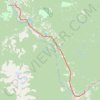
Smithers - Houston

Canada > British Columbia > Regional District of Bulkley-Nechako > Smithers

#Bike #Smithers #Houston

Distance: 65.6 Km • Elevation gain: 642 m • Maximum elevation: 842 m

Gear up for your next adventure:

💨Windbreakers - Protection from strong winds
🛍️Outdoor Accessory Kits - Bundles for new hikers
🌲Bushcraft Skills Books - Learn navigation, fire-making, and shelter building
💳Travel Cards for Ireland - Convenient payment abroad
🛶Waterproof Dry Bags - Keep electronics and clothes dry during wet treks

As an Amazon Associate, this site earns from qualifying purchases at no extra cost to you.