
Railroad Tunnel Trail to Lakeview Overlook and Hoover Dam in Lake Mead National Recreation Area
The Railroad Tunnel Trail offers a unique blend of history and stunning scenery. As you walk along this well-maintained path, you'll traverse five tunnels that were once part of the railroad used for the dam's construction, all while enjoying panoramic views of Lake Mead and the surrounding desert landscape. It's a relatively easy hike, perfect for families, though it's best to avoid the heat of summer and opt for cooler times of the year. #Hiking #Lake #River #Nature
- Distance: 14.7 Km
- Elevation gain: 495 m
- Maximum elevation: 521 m
- Elevation loss: 500 m
- Minimum elevation: 366 m
- Moving time: 2 h 50 m
- Moving speed: 5.2 Km/h
- Maximum speed: 23.4 Km/h
- Total time: 3 h 14 m
- Global speed: 4.5 Km/h
Interactive trail map
Trail profile
- Distance: 14.7 Km
- Elevation gain: 495 m
- Maximum elevation: 521 m
- Elevation loss: 500 m
- Minimum elevation: 366 m
- Moving time: 2 h 50 m
- Moving speed: 5.2 Km/h
- Maximum speed: 23.4 Km/h
- Total time: 3 h 14 m
- Global speed: 4.5 Km/h
About this trail
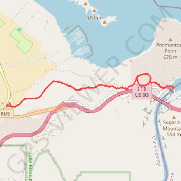
Name: Railroad Tunnel Trail to Lakeview Overlook and Hoover Dam in Lake Mead National Recreation Area trail, distance, elevation, map, profile, GPS track
Start: River Mountains Loop Trail, Clark County, Nevada, United States (36.01146 -114.79418)
Coordinates: 36.01085 -114.79436 36.02014 -114.73700